Solidere’s CBD: Geometries of Conflict and Sovereignty
Marina Kapetanaki
Chris Reizis
Marina Kapetanaki
Chris Reizis
Our research focused on the key political events regarding the post-war
reconstruction in Central Beirut District, as well as the upheavals which
occurred in October 2019. Τhe reconstruction projects, accomplished within the neoliberal objectives
of the new-founded state, turned the district into the locus of a new urban governance,
which asserted the financialization of land. As an opposition to the general
instability and inequalities, the revolted movement(s) of October 2019
reclaimed areas of the district. The streets could no longer be considered as
urban voids, but, instead, their dense mass, turbulence, rigid and dynamic
limits collapsed altogether into a spatiotemporal state of contingency.


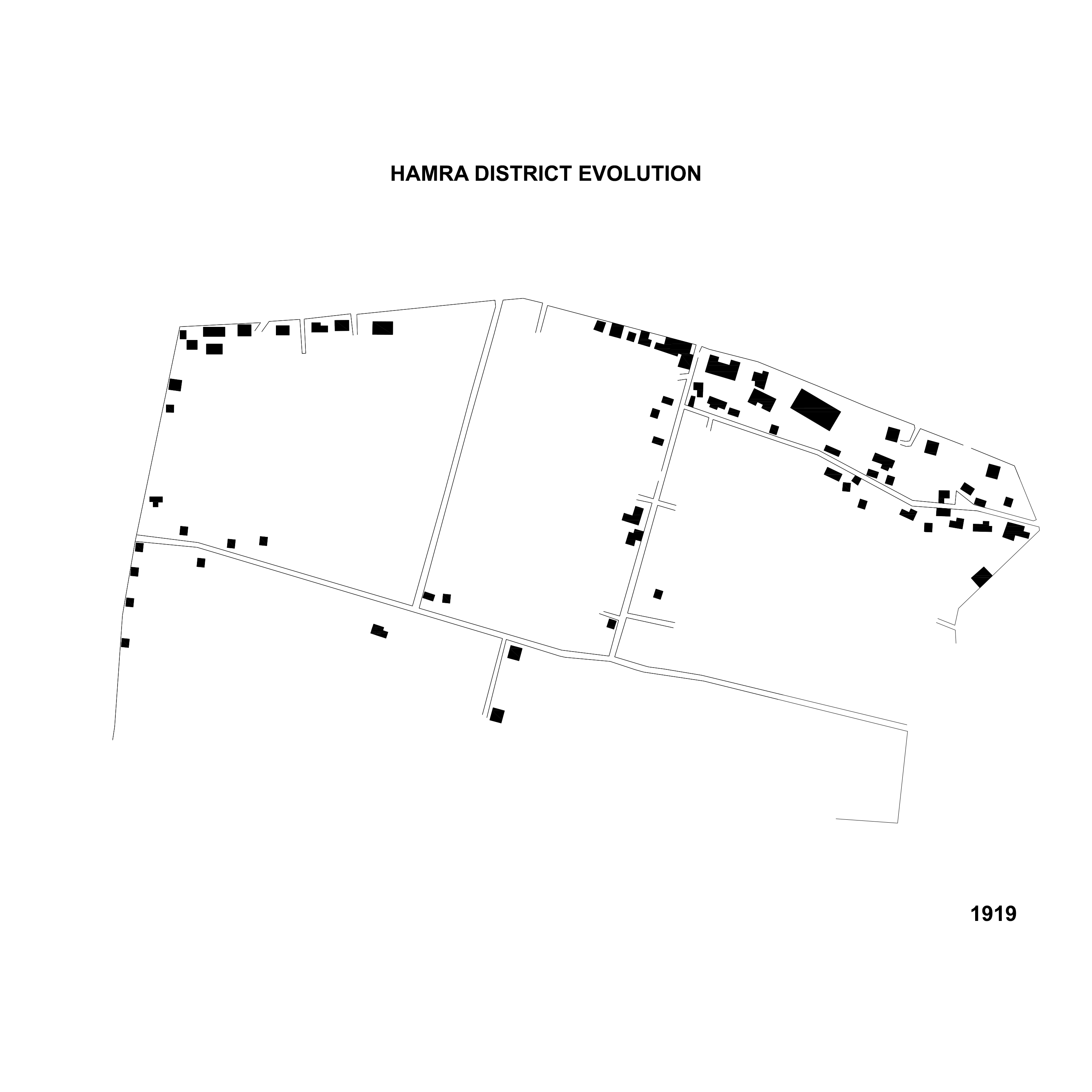
The Levantine city and the invention of Ottomanism
1830-20
Florentia Xanthakou
Florentia Xanthakou
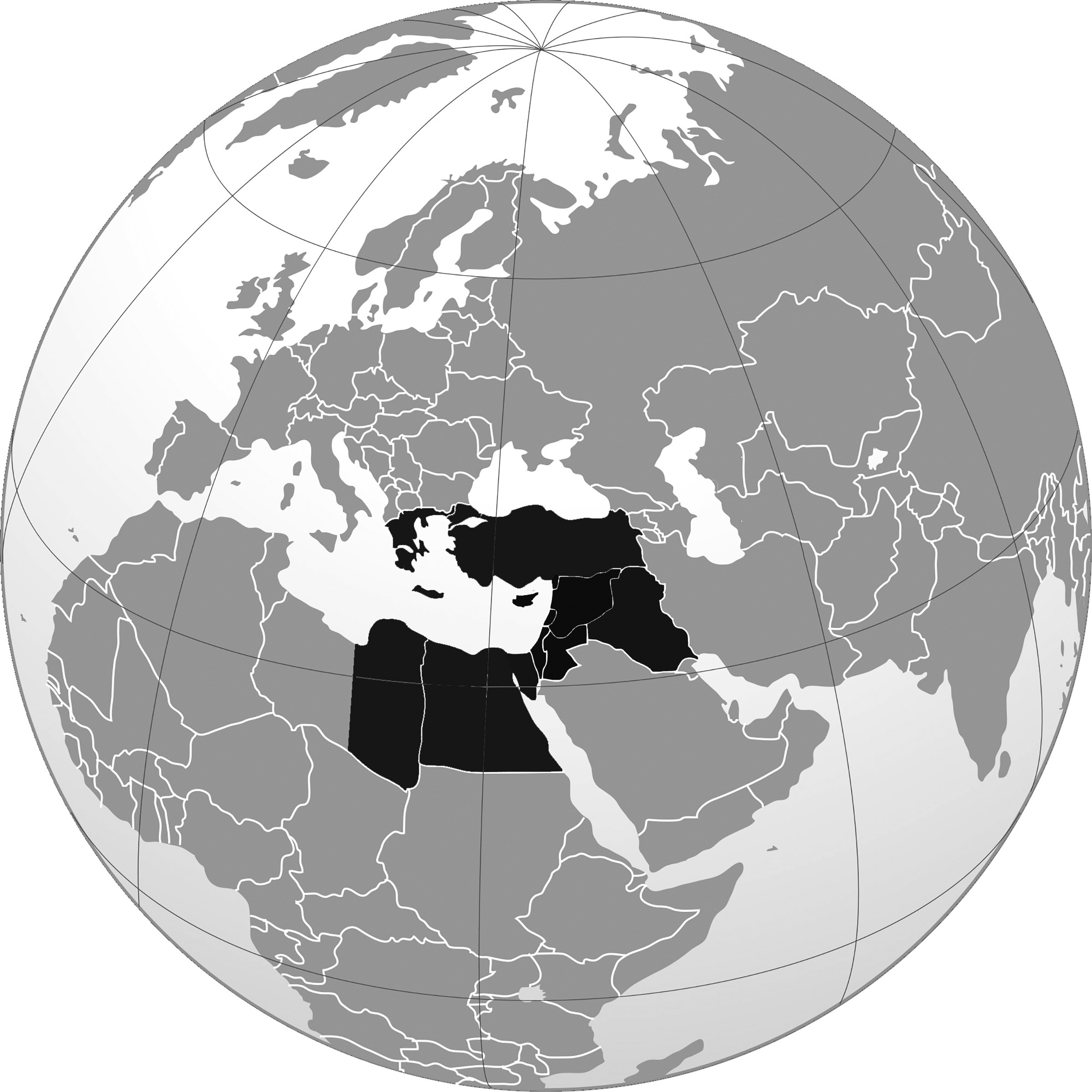
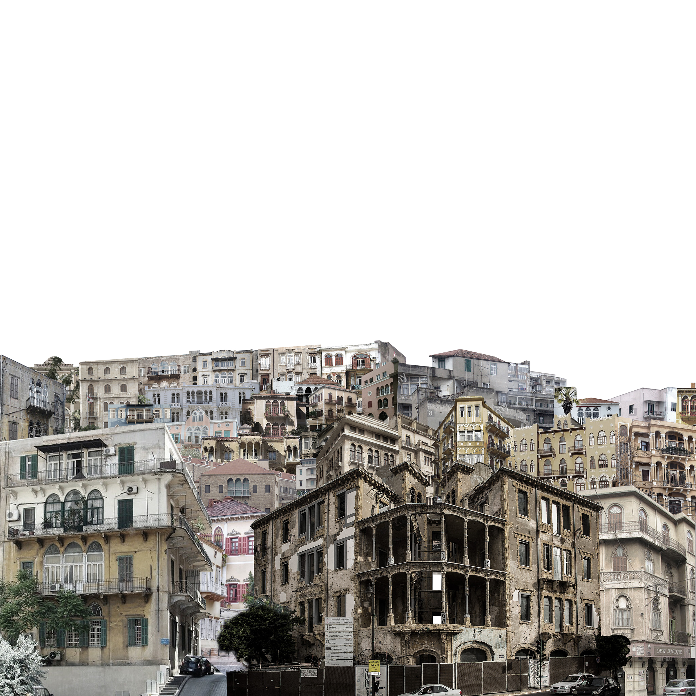
"The Levant" is a term, used for a large geographical area,
covering the Eastern (Mediterranean) part of Western Asia. As it was, and still
is, covering lots of big (in population) countries, many different cultures,
traditions and people were met and united in its boarders, making "The
Levant" a, really, rich place. Ottomans were able to rule only few urban
areas because the country had it's own leaders, always depending on the loyalty
and the ability to rule. Mount Lebanon, though, was under the Ottoman Empire
until the year of 1918 (when World War I finished). Historically, in the year
of 1840, the port of the city Beirut - today, the capital of Lebanon and the
largest city , which was part of the Ottoman Empire, was considered secondary
because of its small amount of population (5000). Few years later (year 1915),
that amount of population went up to 130.000 making the port of Beirut one of
the most important, for those years, port between Syria and Europe. Few more
remarkable works at that time, were the creation of the Beirut-Damascus Road in
the year of 1863 as well as the expansion of the Beirut port almost 30 years
after (1895).

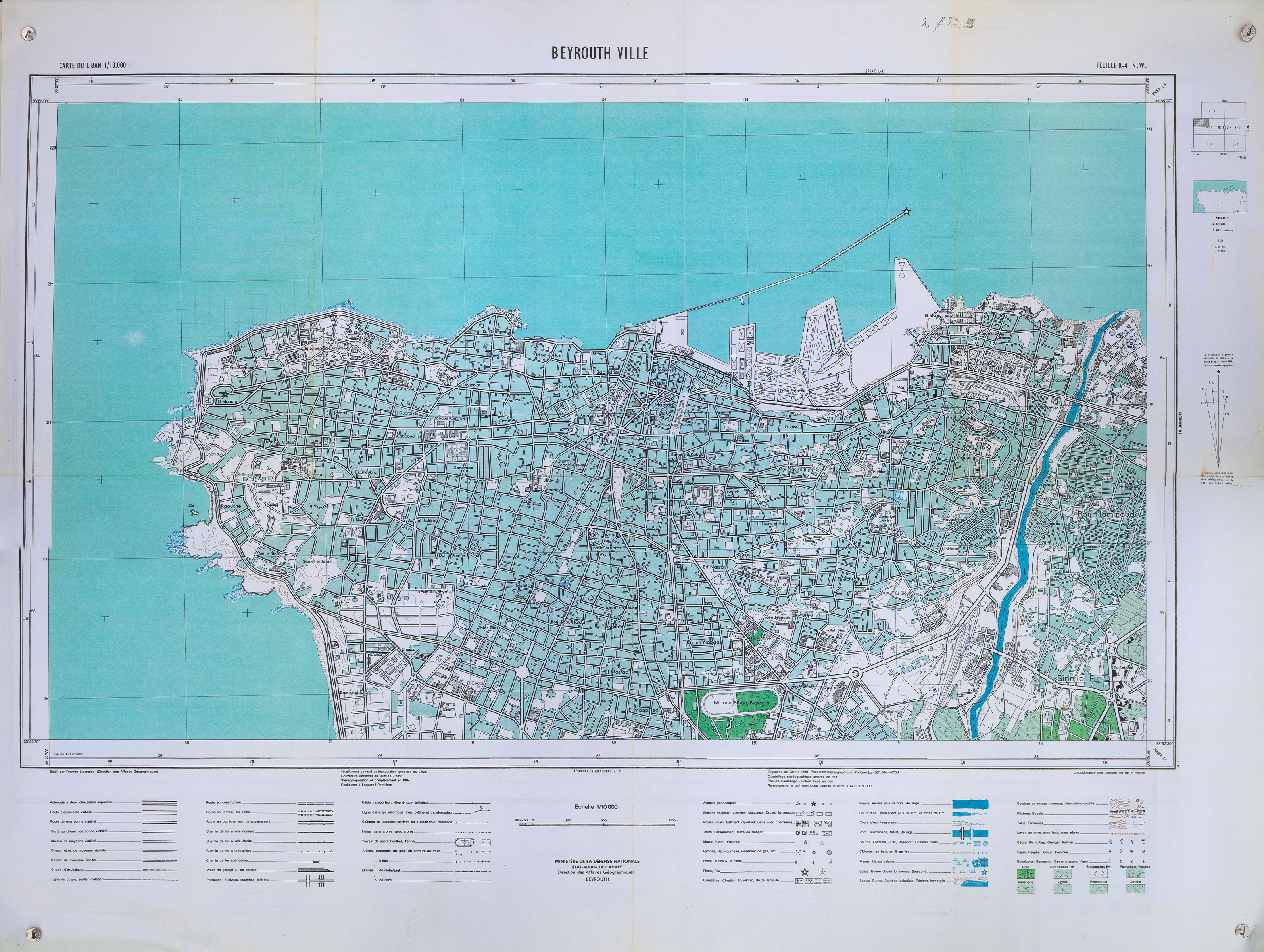
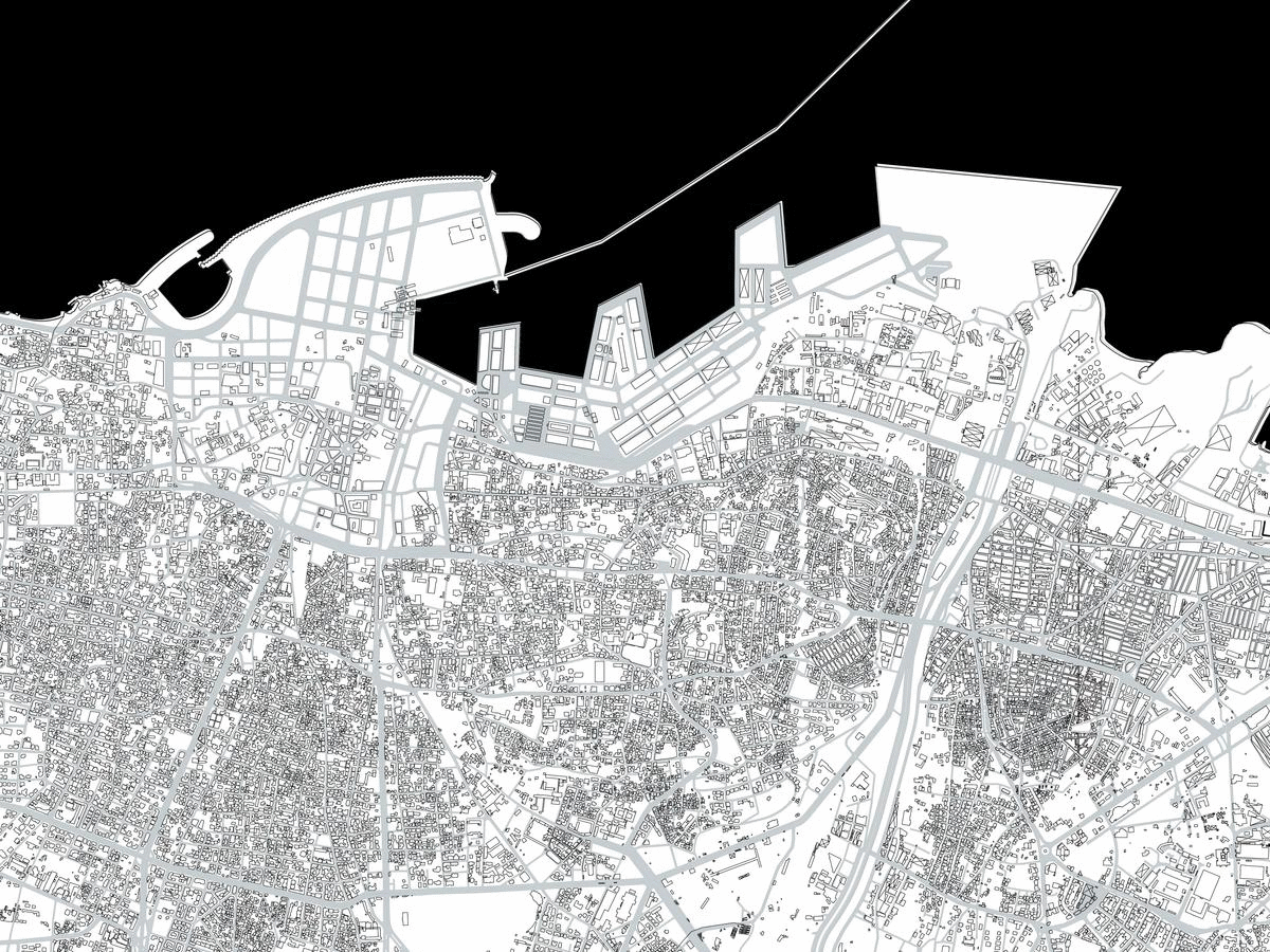
Solidere’s CBD
Mary Asimakopoulou
Iris Sofia Lintovoi
Mary Asimakopoulou
Iris Sofia Lintovoi
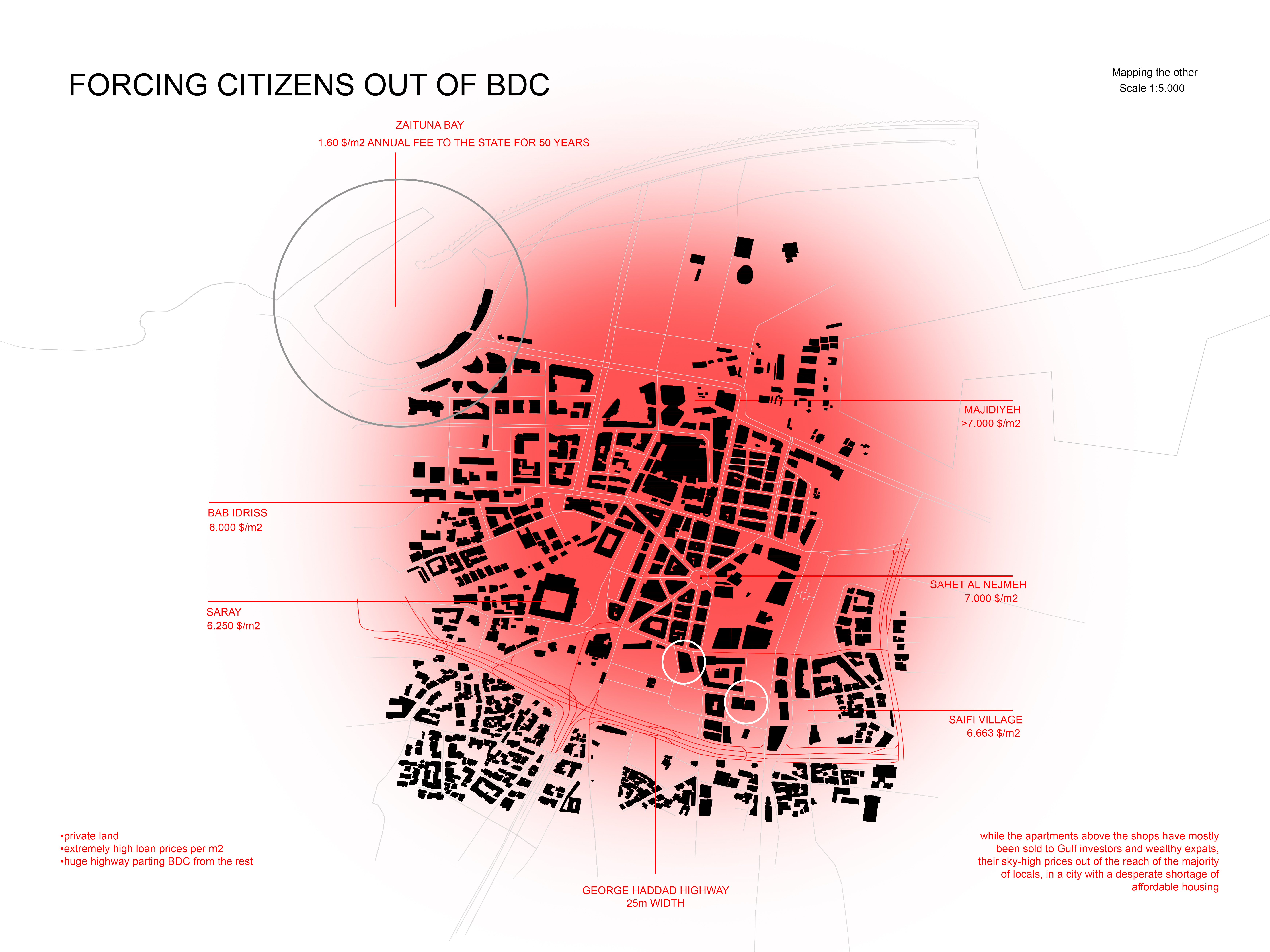
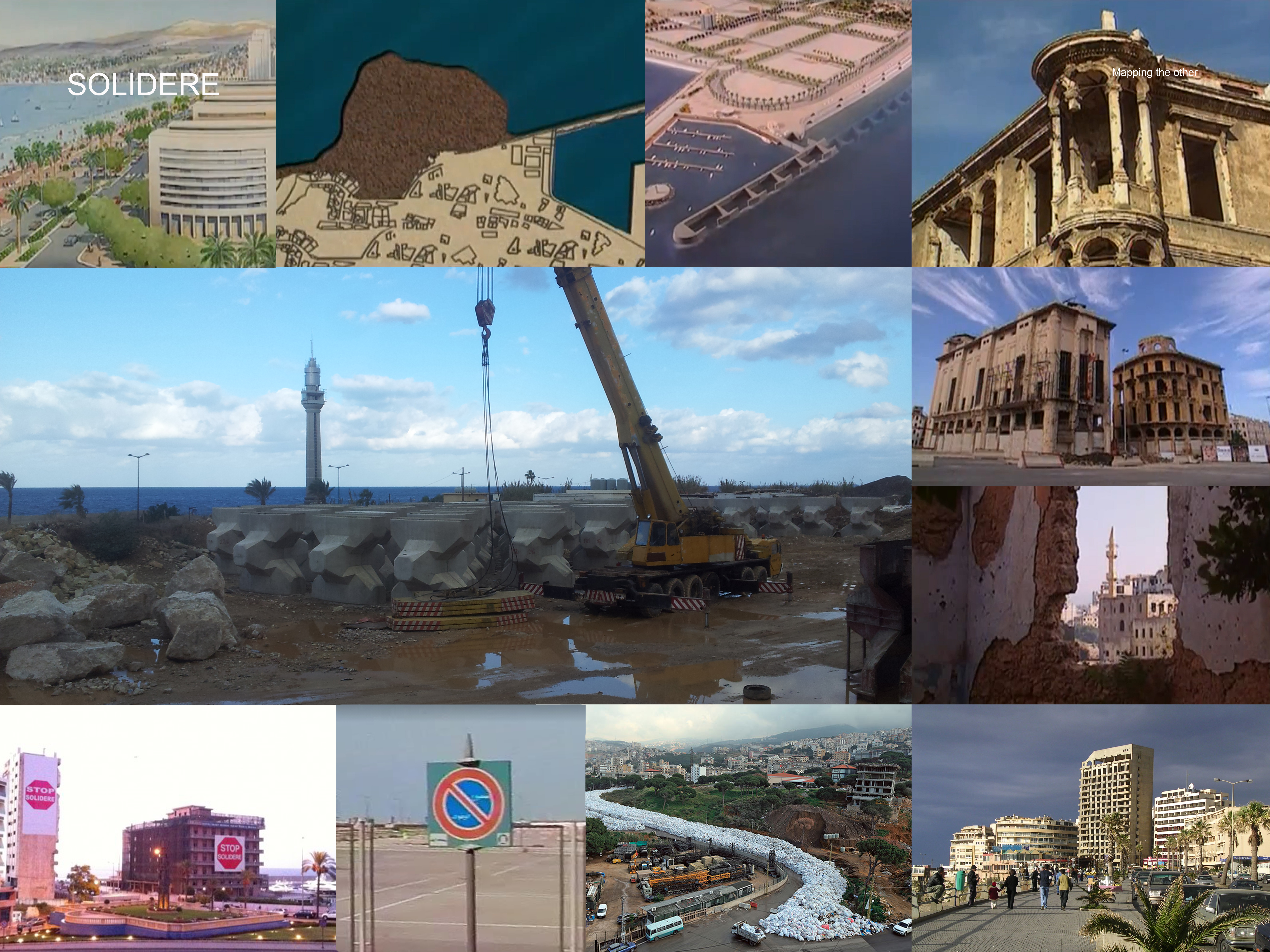
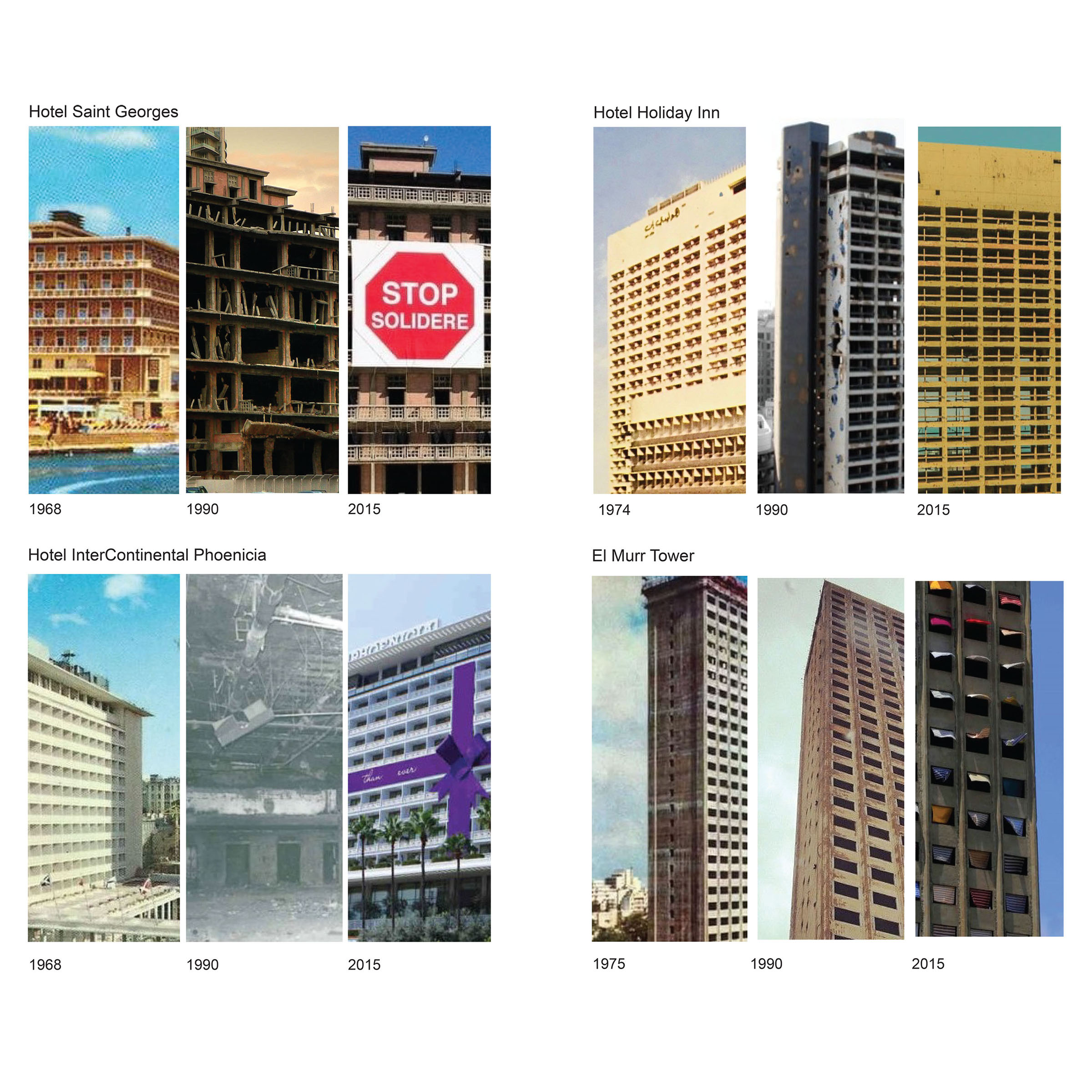
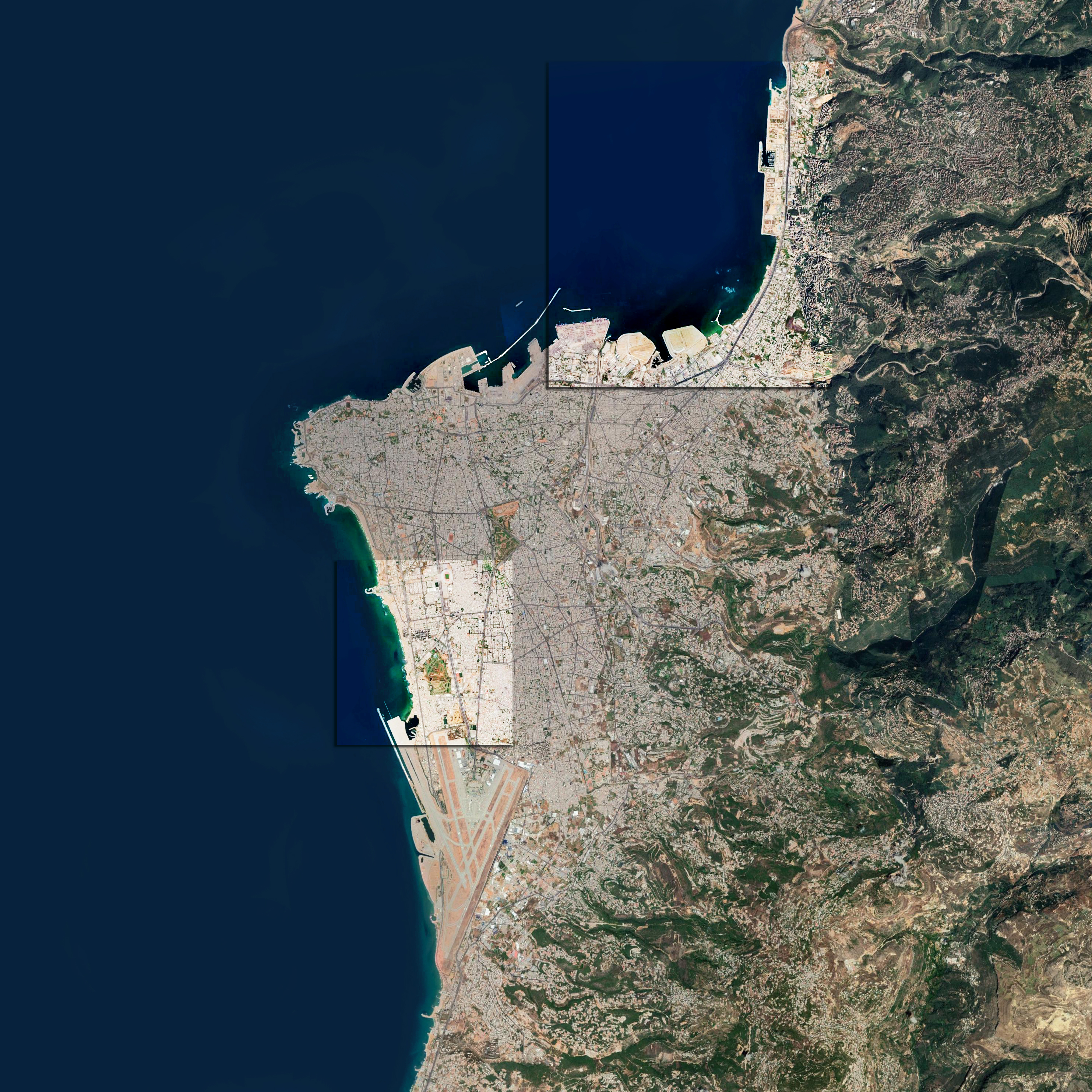
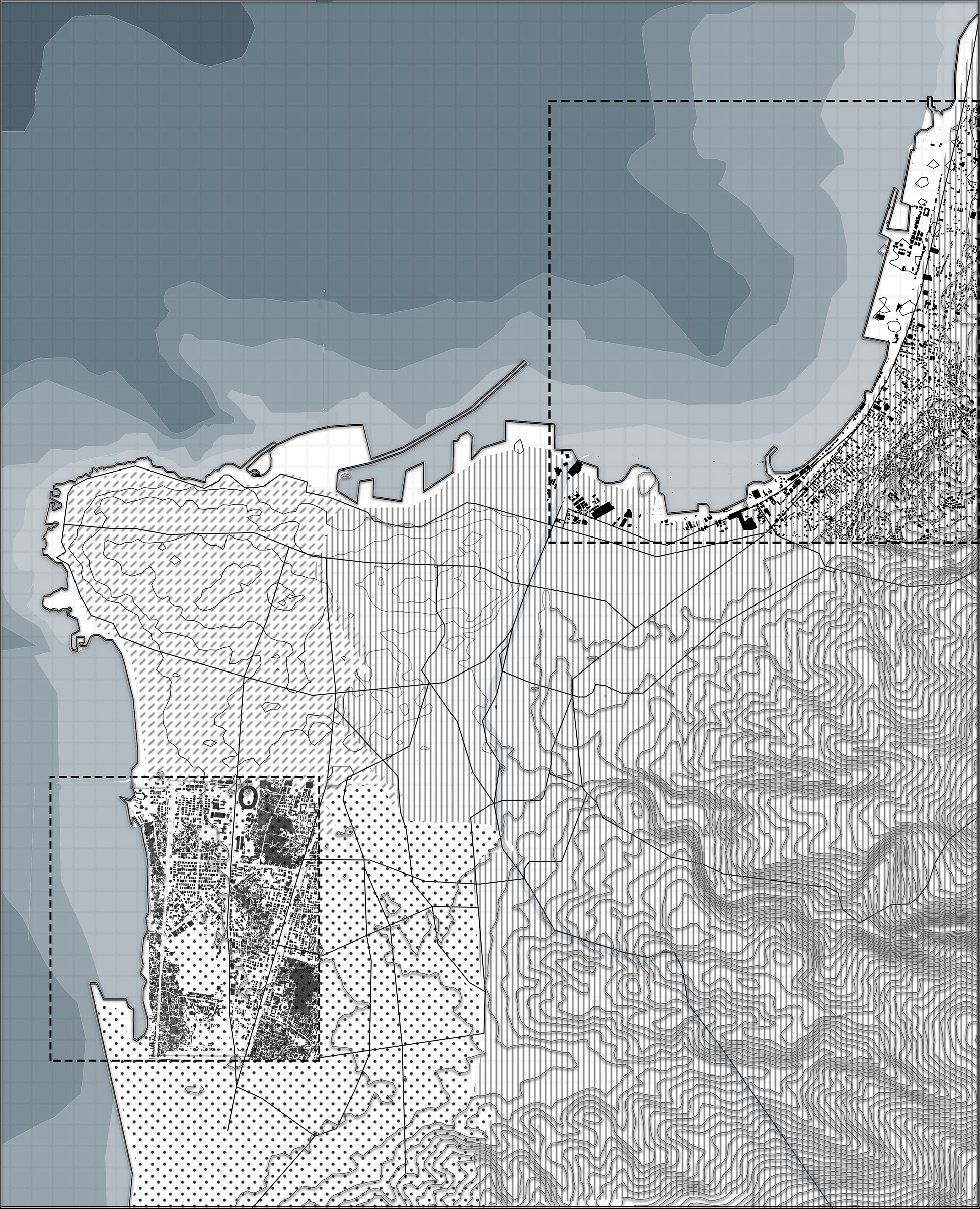
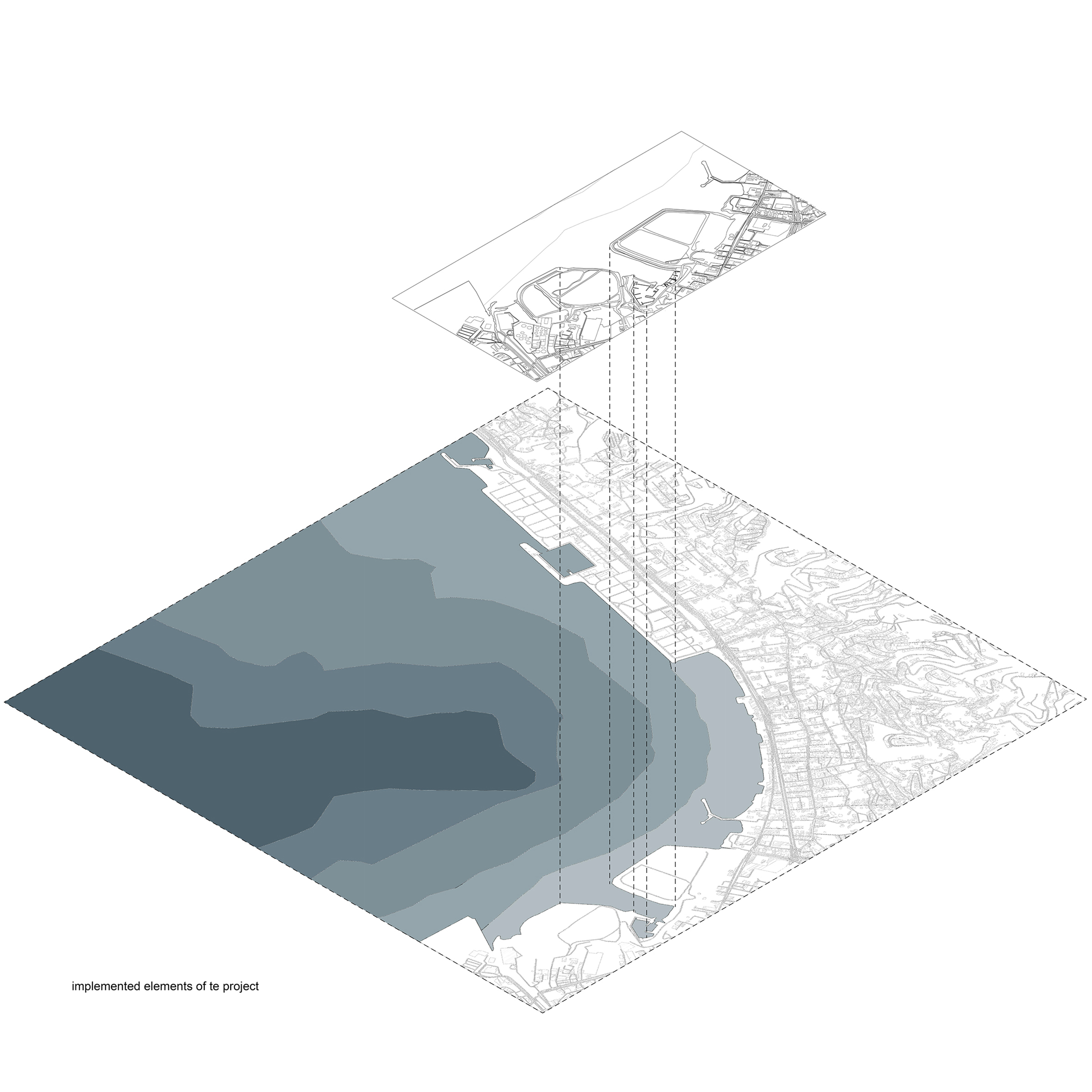
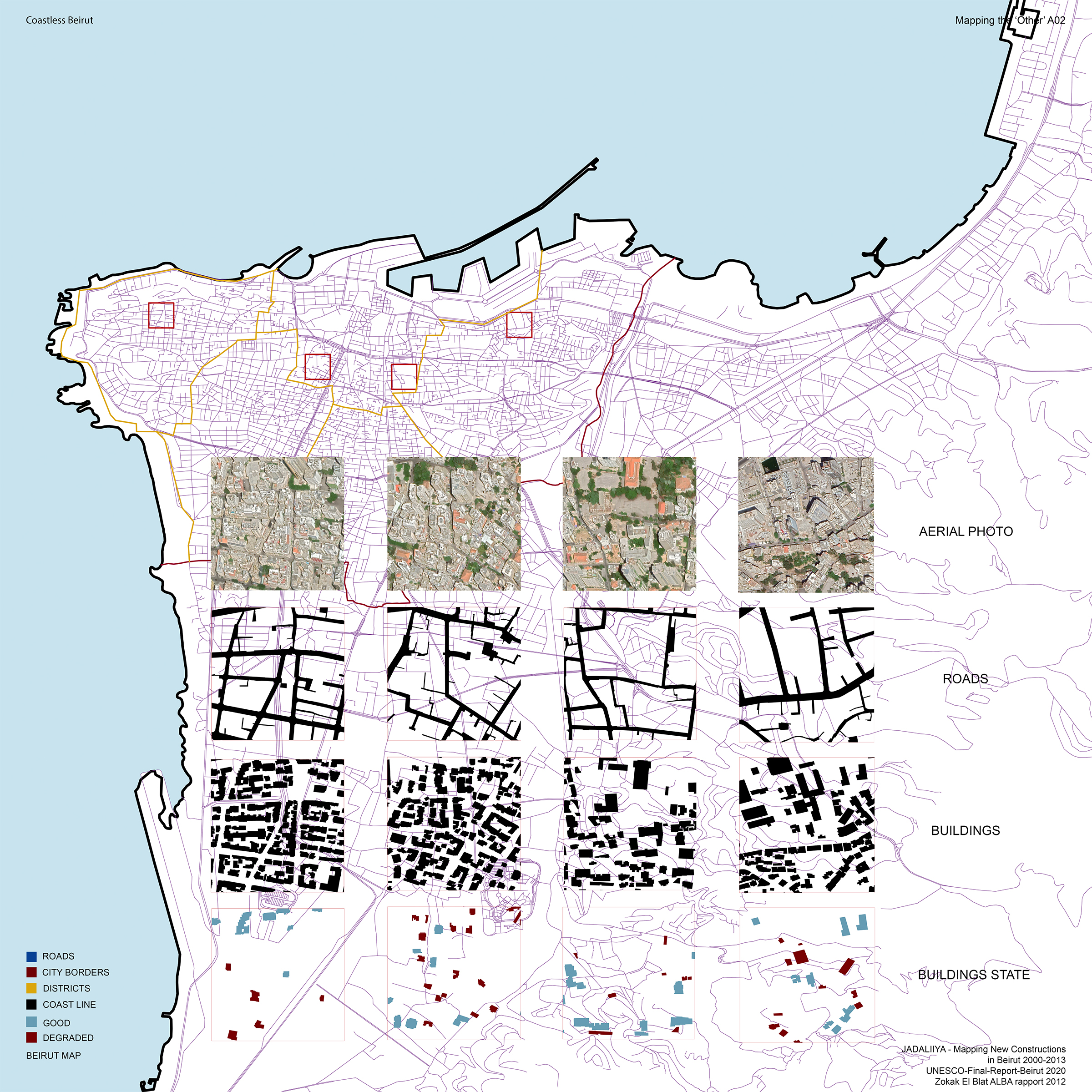
“Mapping
the other” consists of an analysis of SOLIDERE’s project to reconstruct the
Central Beirut District and its impacts on the people of Beirut. After the end
of the Lebanese Civil War in 1991, 80% of the city center had been erased. The
private Lebanese Company Solidere
(Société Libanaise pour le Développement et la Reconstruction du
Centre-ville de Beyrouth) founded on 5 May 1994 was commissioned by the
Lebanese businessman and Prime Minister Rafiq al-Hariri to take charge of
the real-estate and proceed with the development and reconstruction of the CBD.
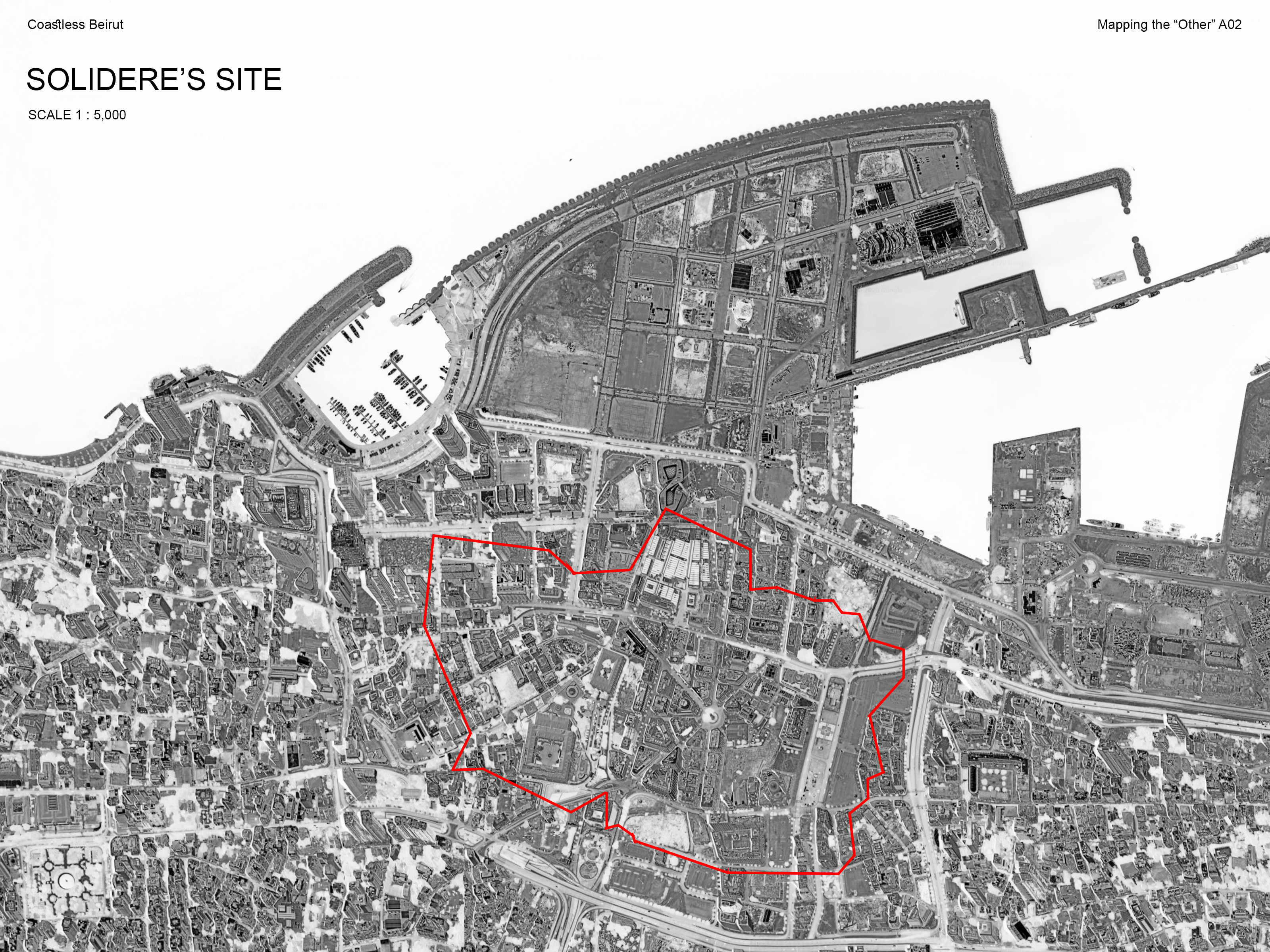
The Solidere site, anchored by Martyr Square and cut in half by the Green Line,
covered 1.8km2,approximately one-tenth of the destroyed city
area. Taking into account its huge historical value, it was decided that an archaeological
protection plan would be implemented, in order to restore and protect more
than 260 structures dating back to Ottoman Empire. Additionally, the Normandy
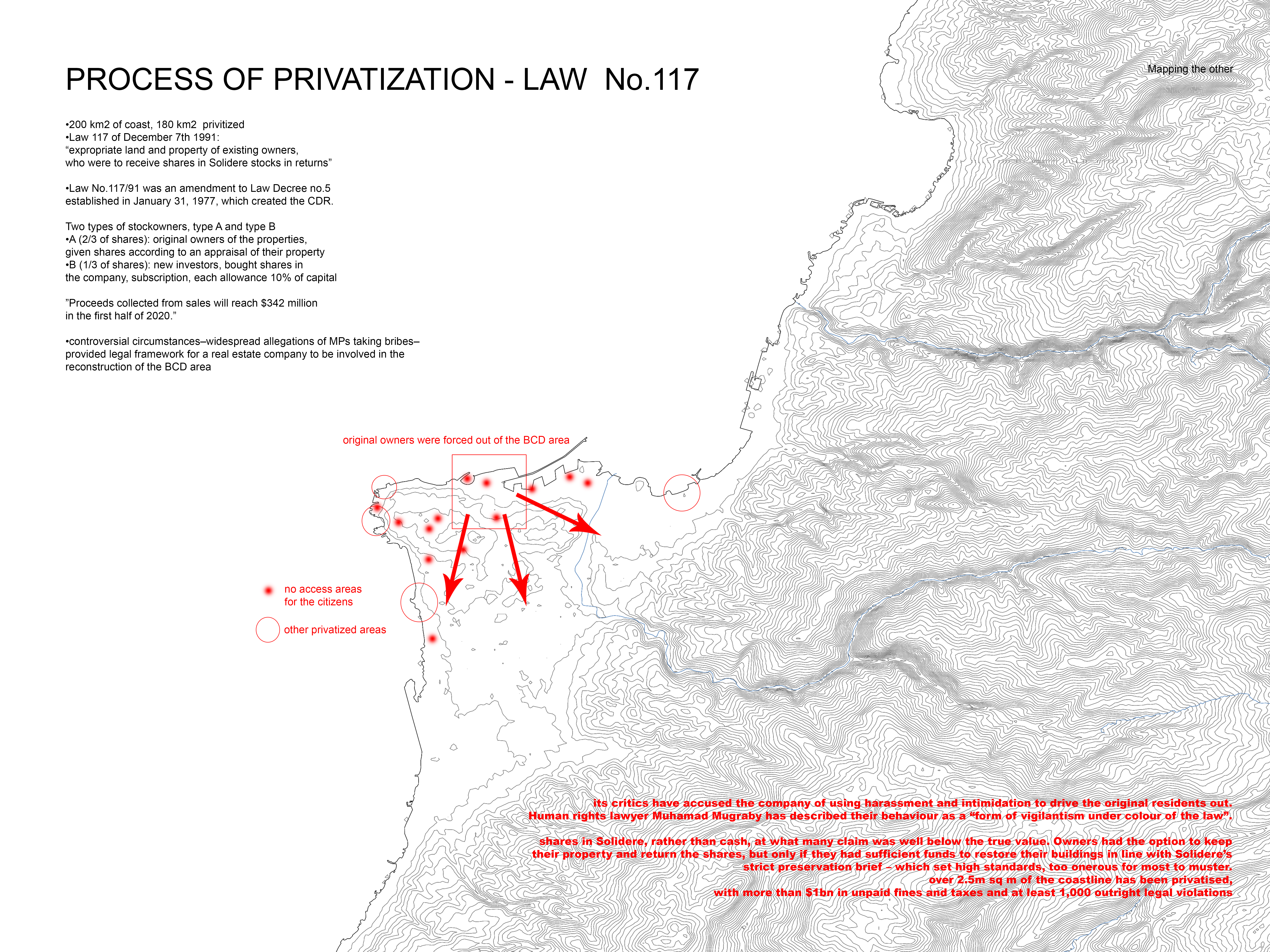
landfill (holding 20 years of waste and toxic gases) was to be developed into a marina.The mapping research highlights how Solidere managed to create more
conflict, due to the destruction of significant
historical buildings and limiting Beirutis access to the sea through
the privatisation of the coast. After the vote of Law 117 in December 7th
1991, the company was allowed to expropriate the property of existing owners,
who were to receive shares in Solidere stocks, well below their marketvalue.
Anyone not able to abide by Solidere’s strict preservation brief was basically
forced out of the BCD area.

[Civil] Wartime urbanisations 1975-90
Eftihia Bourdakou
Ioanna Chatzifotiou
Eftihia Bourdakou
Ioanna Chatzifotiou
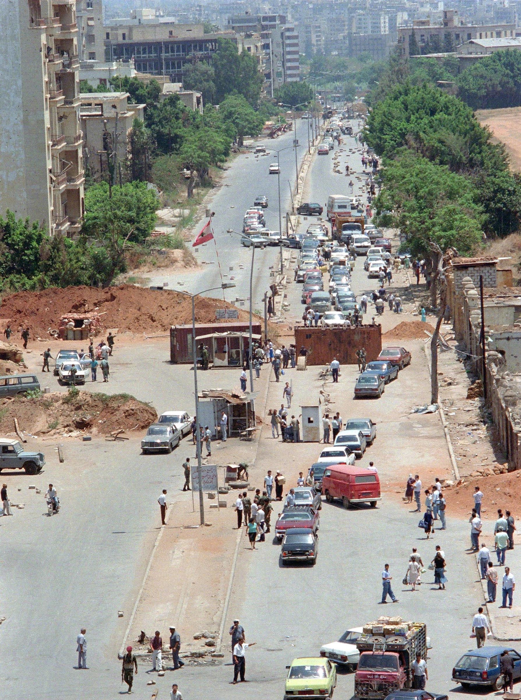
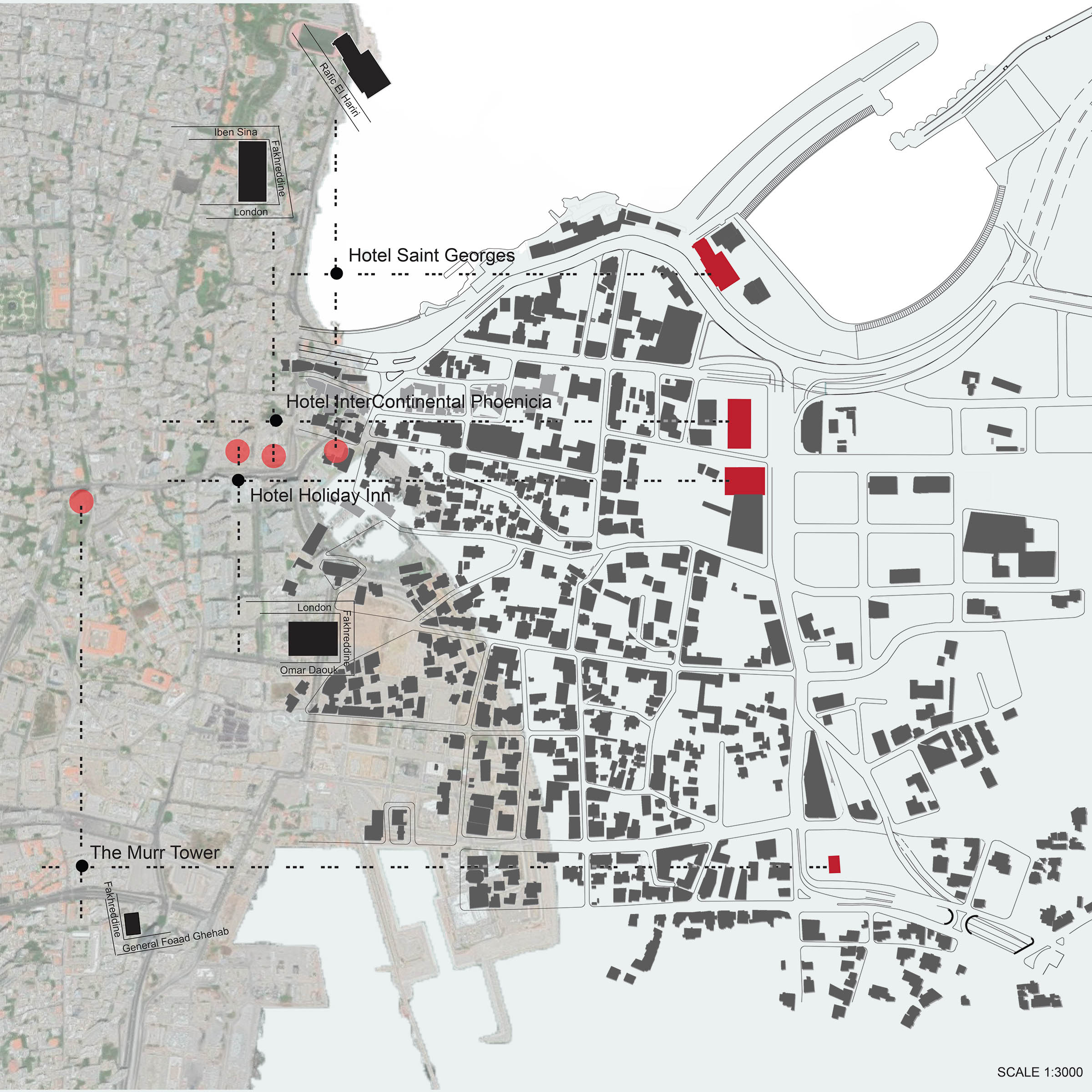
In 1975, a civil war broke
out in Lebanon between Christian phalanxes and Palestinian Muslims. Beirut was
divided by religion for 15 years. Christian on the east side, Muslim on the
west. A green line extended northwest of Damaskou Street, starting at the
Mediterranean Sea and Martyrs' Square to the north and crossing about five
miles south of Beirut. It was so named because of the dense vegetation that
developed along it. Along the line there were fighters' hideouts, sniper spots,
tanks, buildings with bolted windows, sandbags. For people living nearby, Line was
a way of life. Although some efforts have been made to restore damaged
buildings, most of them have been deserted or destroyed and remain part of the urban
image. A significant scar was the Battle of the Hotels (1975-77), one of the
earliest and most violent confrontations of the war which occurred in the
Minet-el-Hosn hotel district of downtown Beirut.


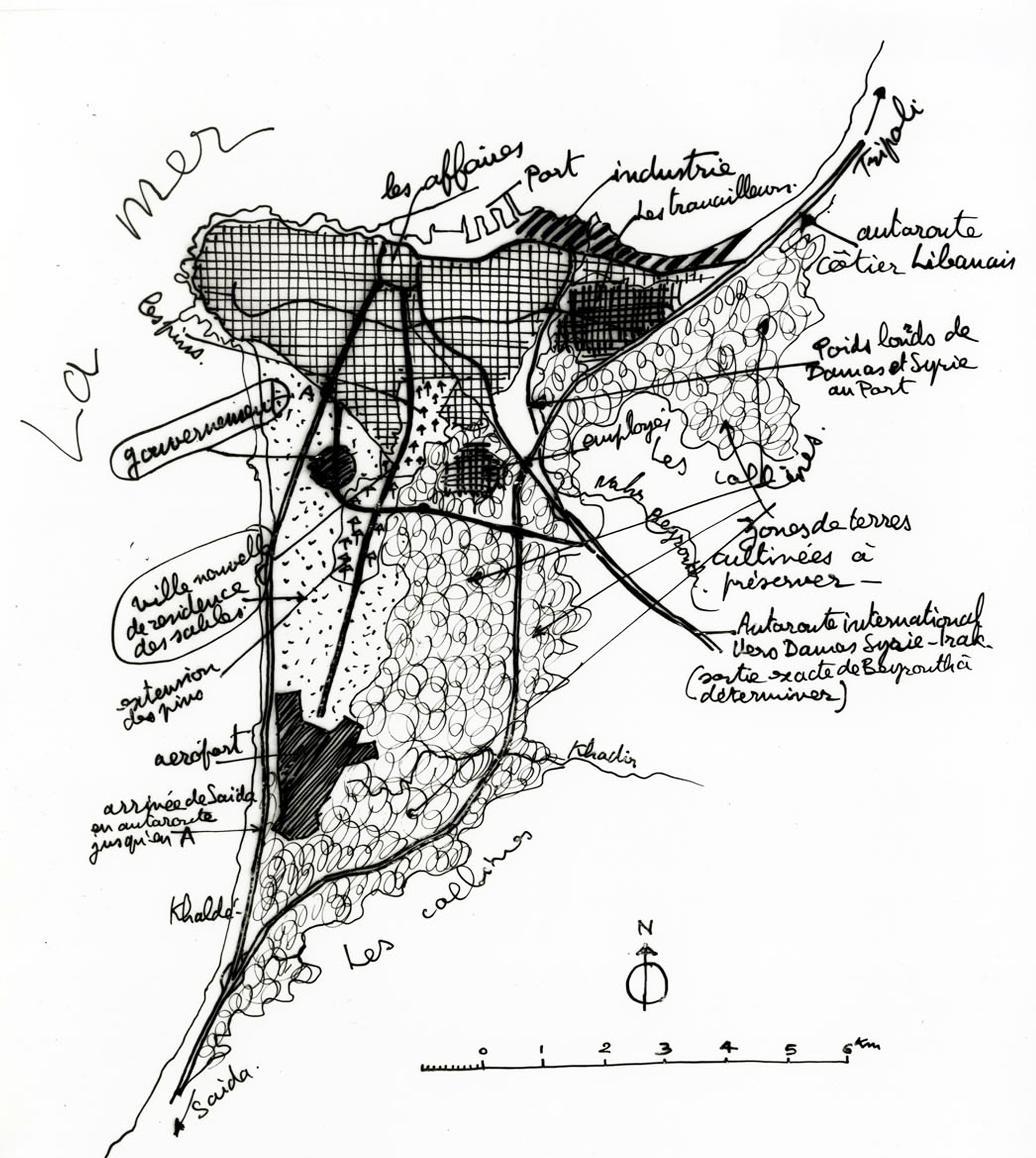
Elyssar and Linord project
Andreas Makentoudes
Manto Souliotes
Andreas Makentoudes
Manto Souliotes
Elisar project, proposed at 1995-97,is a public establishment that aims
at the restructuring of the western part of the southern suburb of Beirut. It
will have been a 'decent' urban linkage
between the airport and the city center. The total project area is 560
hectares, from which only 230 hectares are legal constructions and only this
buildings are exempted from demolition. The remaining 330 hectares were placed
under study. These areas, in turn, are distinguished by their high density and
their irregularity, from Bir Hassan, Ramlit al-Baydan, and the adjacent area
next to the airport road, and will likely be destroyed and reconstructed
according to regulations set in the general plan. The displaced residents will
be relocated in 7,500 housing units to be built along the airport road. The
shops and small industries that are an integral part of the illegal sectors
will also be relocated in industrial zones situated near the residential
areas.Although Elisar is a project led by three antagonistic actors (Rafik
Hariri, Amal, and Hizbullah), their conflicts seem to fade away when it comes
to its urban conception.Essentially, their friction concerns only the economic
and real estate issues, and in the cases of Amal and Hizbullah, the control of
the social groups that legitimize their power.Finally, apart from a part of the
infastructures, the rest of the project was not carried out due to political
conflicts, financial shortages, and various problems caused by the
compensations that had to be given.
Project Linord, in the 1990s, involved the reclamation of 1.4 million square kilometers of land to accommodate essential infrastructures for public services, such as a sewage treatment plant or roads, as well as commercial or real estate developments.Linord project characteristics: One of the largest projects environmental development in Lebanon, It has an execution of a sewage primary treatment plant & rehabilitation and protection of existing sea outfalls, rehabilitation of Burj Hammoud waste dumps of District Park,a tank farm to be sold to oil and gas companies.The Linord Project is divided into 3 parts: The mixed used part which is made of a residential, the leisure and a commercial area,a tank farm and business area and the third part is based on infrastructure which is from Beirut.
Project Linord, in the 1990s, involved the reclamation of 1.4 million square kilometers of land to accommodate essential infrastructures for public services, such as a sewage treatment plant or roads, as well as commercial or real estate developments.Linord project characteristics: One of the largest projects environmental development in Lebanon, It has an execution of a sewage primary treatment plant & rehabilitation and protection of existing sea outfalls, rehabilitation of Burj Hammoud waste dumps of District Park,a tank farm to be sold to oil and gas companies.The Linord Project is divided into 3 parts: The mixed used part which is made of a residential, the leisure and a commercial area,a tank farm and business area and the third part is based on infrastructure which is from Beirut.


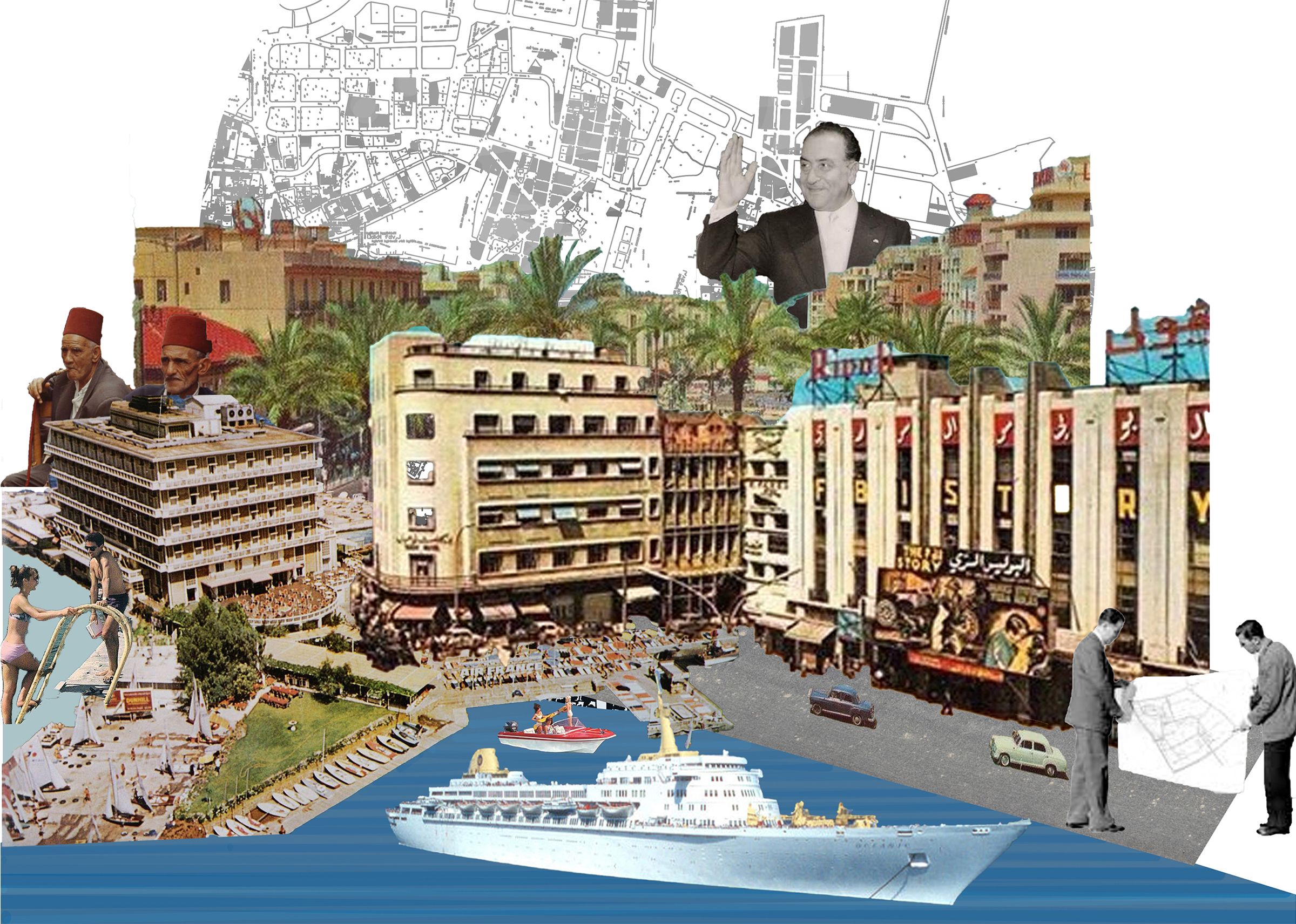
The Golden Age of the Modern | Shihabist and Post Shihabist Period 1958-1975
Anastasia Nikolaou
Anastasia Nikolaou
1958-75 is a period of consolidation for modern
architecture in Lebanon.
The period, happier
and more progressive in many aspects, contrasts the postwar state of ruin and
desperation.
Lebanese architects were undertaking large
scale projects in the Gulf region, gradually developing a distinct Modernist and Mediterranean aesthetic.
The overall political and economic conditions facilitated the
growth of a new direction in architecture with
two distinct characteristics:
Functionalism
which is an intersection of brute facts of utility with objective design
methodologies and standardized means of production and avantgarde which combines self-critical formal practice as well
as the incorporation of advanced technology. This
may have been a time of creativity and production yet as a critique one has to mention that often buildings and their architecture were ignorant of the actual socio-economic problems merely just replicating the practices of the West.


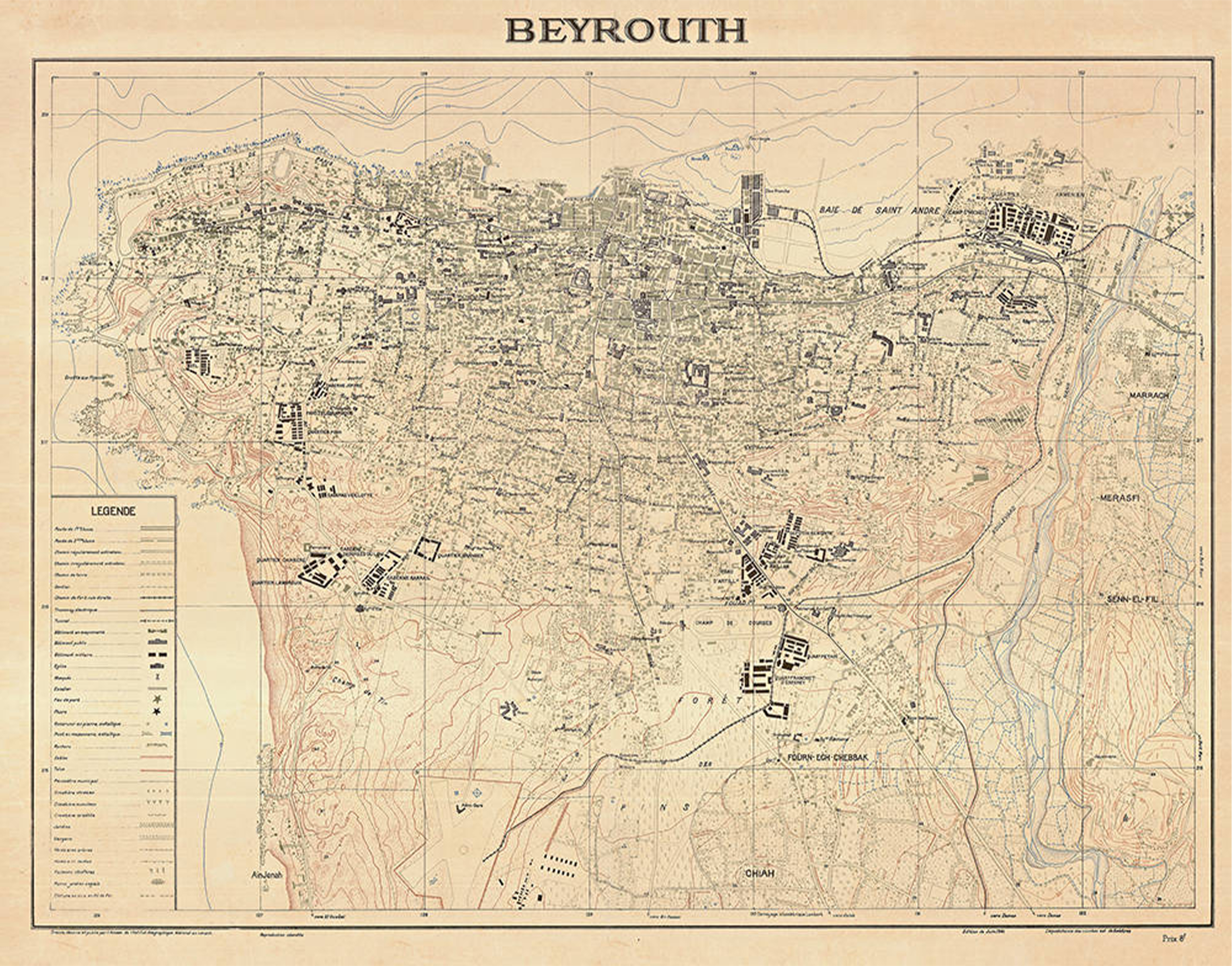
Ecochard
in Lebanon: the 1943 & 1963 masterplans
Kyriakos Tofitzikis
Kyriakos Tofitzikis
During the French Mandate the
earliest city plan was drawn by Danger in 1932. It was the first attempt at a
comprehensive study of the capital taking geographic, climatic, geological and
human factors into consideration. It determined the major axes of circulation.
It, also, recommended and located all the necessary utilities and recommended
that the outskirts of Beirut be considered as independent villages. However,
the Danger Plan was never approved. In 1942 the Ecochard Plan was commissioned.
After two years of development the plan was submitted for consideration in
1944. It’s major features were that it
provided the main transportation arteries. It offered a survey of existing open
spaces and gardens.
It went into
detail about zoning, industrial location and all the dwelling categories. However, Ecochard’s Plan was not
approved, though many of it’s basic concepts were preserved and introduced in
later plans. In 1954, under the pressure of an
intense explosion the municipal administration commissioned for a plan
establishment. This was submitted and approved, but the plan was nothing but a
network of roads. There was no zoning provided. It never touched any of the
factors that could affect future trends and developments. It made no study to
natural sites and historic monuments of the city. This plan is in effect even
now.Ecochard in 1964 submitted the new
plan and it was approved after modifications. This plan is still in application
now in Greater Beirut.


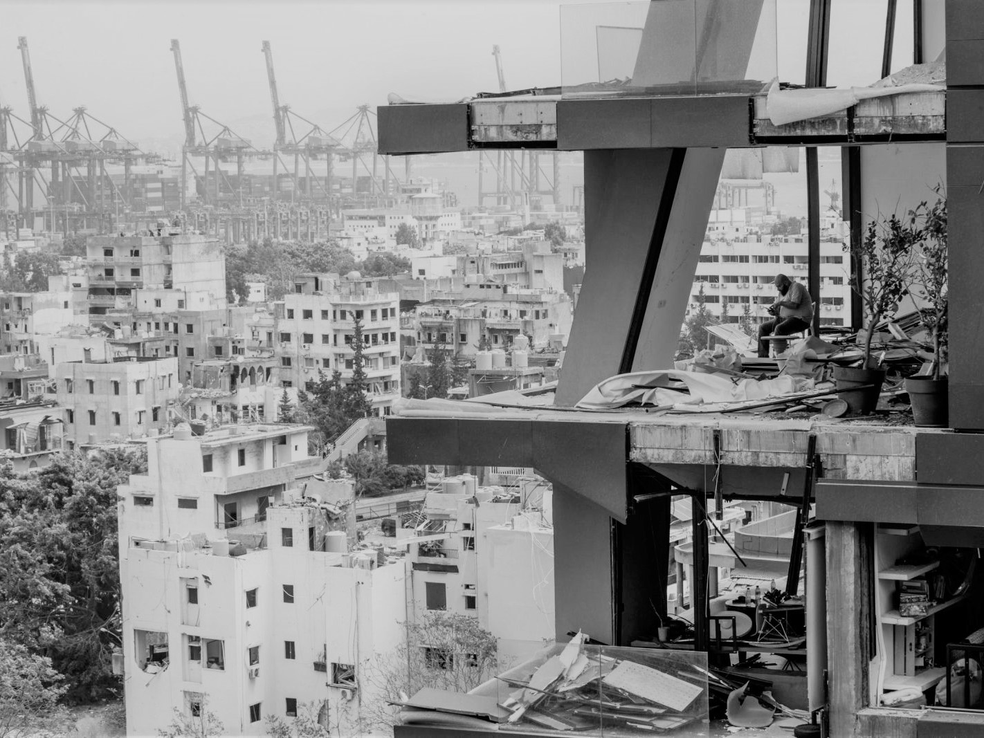
Reclaiming the Commons
Post Blast Beirut August 4, 2020
Konstantina Angelopoulou
Post Blast Beirut August 4, 2020
Konstantina Angelopoulou
On the 4th of August
2020 the huge explosion that denotated in the port of Beirut affected the
surrounding area within 10km. There were 203 dead people and 6,500 injured.
Most of the city’s main hospitals and health care centers are destroyed and
have a lack of medical equipment. 300,000 people are homeless after 50,000 houses
were damaged or were destroyed. 90% of the city’s hotels are damaged. Some of
the city’s most important areas adjacent to the port are seriously affected.
What is the response to this disaster though? It is important to avoid previous
mistakes as a response to disasters, like Solidere. The city needs a
people-centered recovery that will maintain the personality of each area of the
city, while at the same time upgrading it. As Beirut Urban Lab suggests, “four
affected neighborhoods (Mar Mikhael, Gemmayzeh, Geitawi, and Karantina) are
serving as case studies for the initiation of a bottom-up, inclusive and
people-centered recovery process.”. The mapping analyses the pre blast
situation in the 4 neighborhoods, as well as the level of damage that has been
done post blast locally and in the city. The mapping also includes the
coastline change, mainly in the port, from 1890 till 2020 post blast.


The fight for the right to the city
Evangelos Paxinos
Evangelos Paxinos
Lorem Ipsum is simply dummy text of the printing and typesetting industry. Lorem Ipsum has been the industry's standard dummy text ever since the 1500s, when an unknown printer took a galley of type and scrambled it to make a type specimen book. It has survived not only five centuries, but also the leap into electronic typesetting, remaining essentially unchanged. It was popularised in the 1960s with the release of Letraset sheets containing Lorem Ipsum passages, and more recently with desktop publishing software like Aldus PageMaker including versions of Lorem Ipsum.
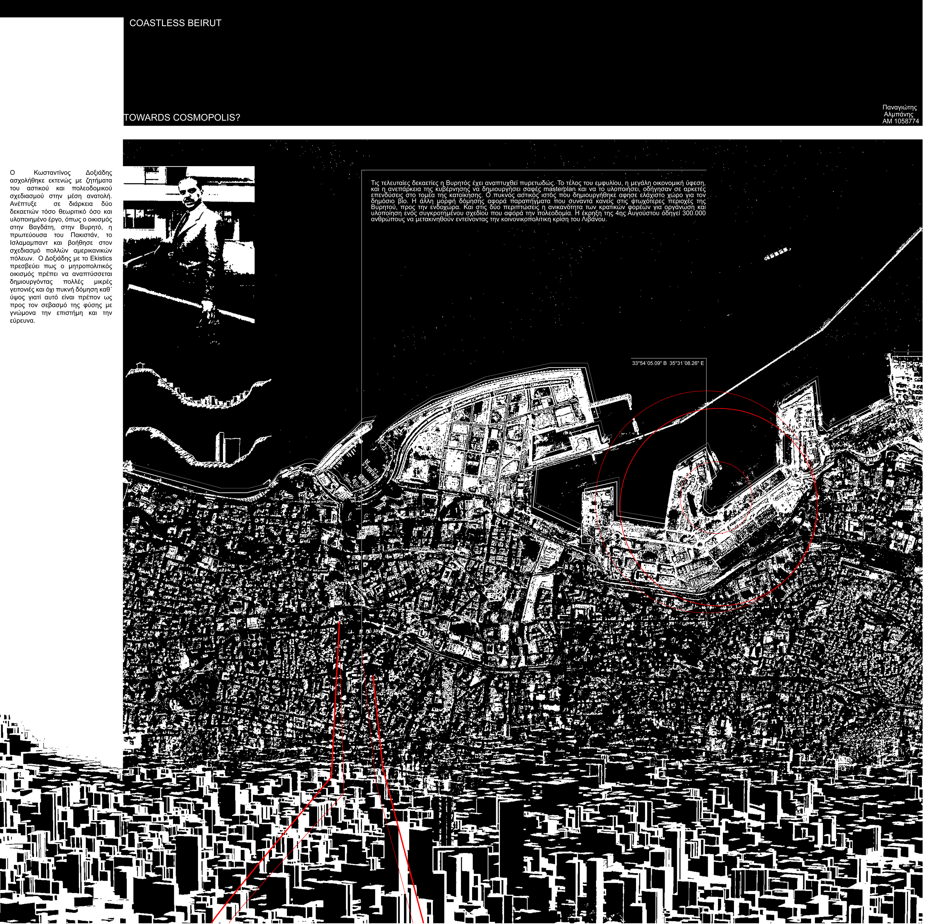
Towards Cosmpolis?
Doxiadis in Lebanon
Panagiotis Almpanis
Panagiotis Almpanis
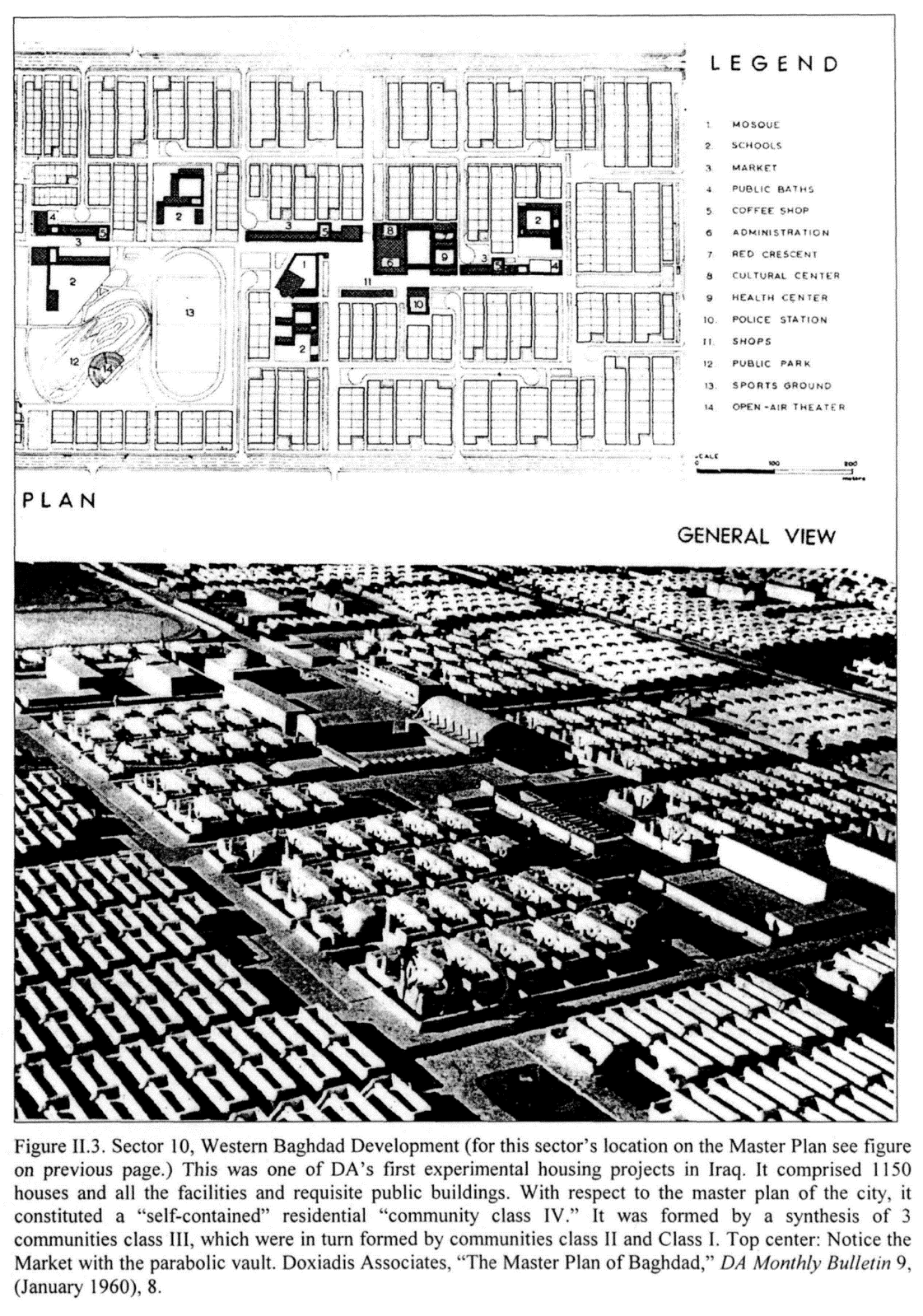
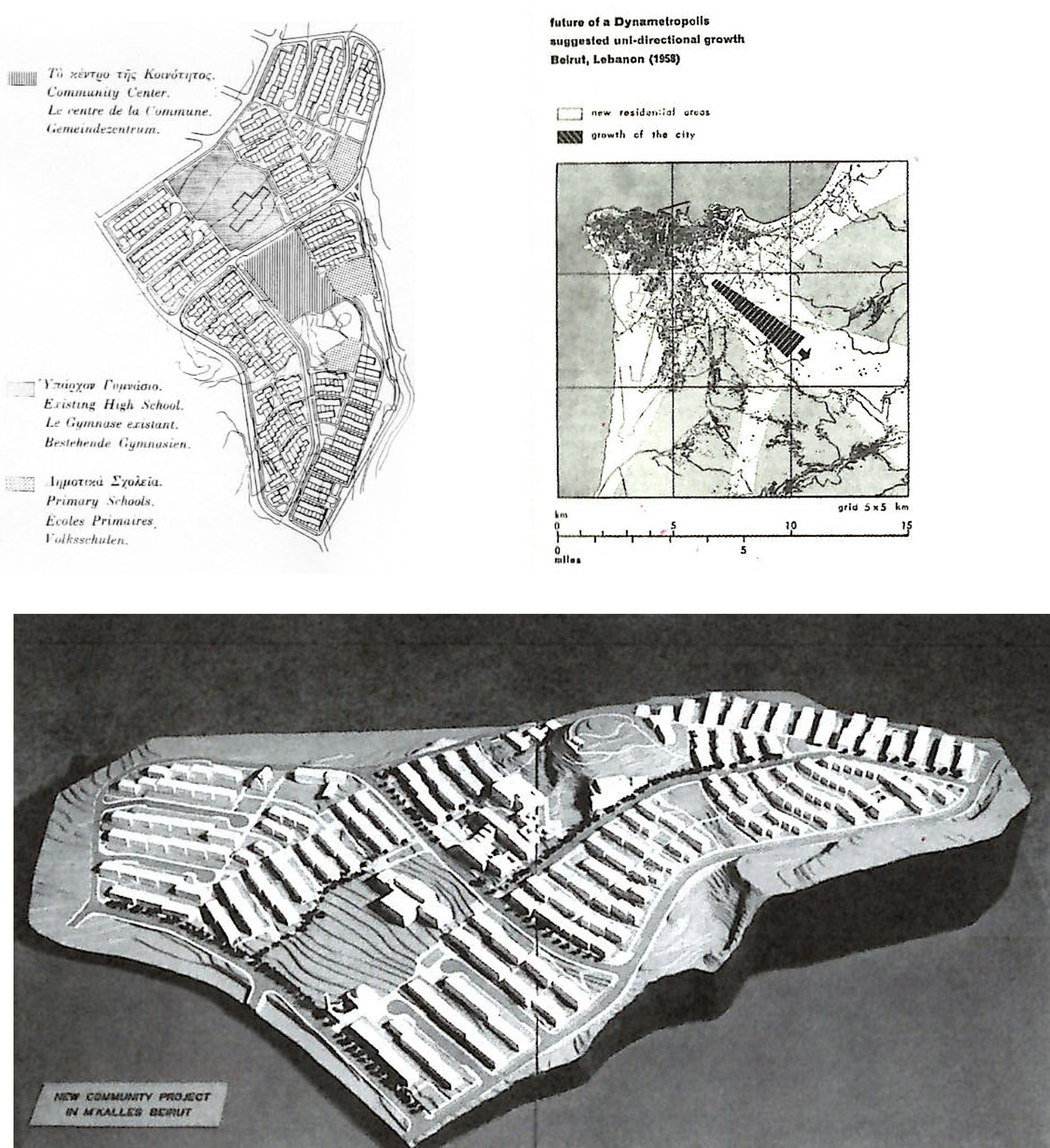
Konstantinos
Apostolou Doxiadis(1913-1975), was a pioneering Greek Urban Planner and Architect of major
projects.
He was invited to
undertake the developmental plan for the region of Mkalles , it was behalf of
the Lebanon Government and the USA International Cooperaton Administration. A
total of 34.000 urban and rural families will be helped by the development of
land in new communities supplied with necessary streets, water, sewerage,
electicity. The first 2500 model houses which were designed have been dviden
into three communities two in area of Beirut (M’ Kallos and Warwar) and one in
the area of Tripoli. The program Has been thought out so as to allow
beneficiaries belonging o the lowes income groups to pay of their houses in 20
years by annual instalments each not exceeding 20 % of the family income. In
this way, th rpogram will not represent an outrigt Government invesment only
until repaymens allow it to have a
revolting fund for its prepetuation. His
first visit in Lebanon was 1958. He was concerned with development and zoning
studies. He also designed the costruction
of three schools in Lebanon, one as a model agricultural center and made
plans for two agricultural colleges.